Mount Katahdin is home to Baxter peak, the Northern terminus for Appalachain thru hikers. Standing at 5,267 feet it is Maine’s tallest peak. Although it is not as tall as NH’s Mount Washington, those who climb it may argue that it is a more difficult climb.
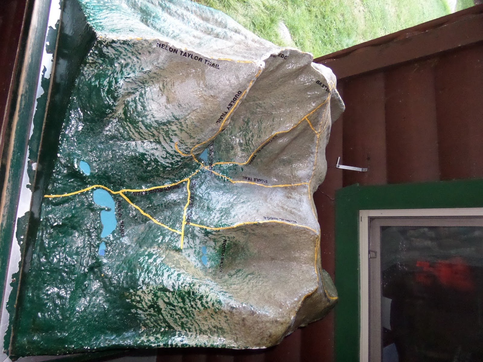
I began my quest to hike Katahdin about four months before the hike. I had to book my camping reservation. For anyone wanting to hike Katahdin, you must either get a reservation or get a day use pass. The campsites are booked online through the Baxter State Park website. Chimney Pond is the most popular campsite. You have to hike in to that site, but it does cut off a good deal of mileage on the day of your hike.
I stayed at Roaring Brook Campground with another hiker, Danielle. The site holds 6, but they’re really small. I hammocked while Danielle used a spacious (it really was!) one person tent. We saw another site with three 2 person tents. It really would be cramped with any more than 3-4 small tents.
A couple of things to note:
~Bring your own water (gallons) as there is no available water here. Some people I met said they had to boil rain water.
~If you are at a tent site, you can usually park at the site. There is a general parking lot for campers.
~The group campsite (there are three) are a good distance away from the main campground and the trailheads.
~There is firewood for sale for $3.00 a bundle.


We were planning on hiking Katahdin on Labor Day, but the weather didn’t look too good. I switched our reservations from Nesowadnehunk Saturday night to a last minute available Roaring Brook campsite for a $15.00 fee. This way we were able to hike Katahdin on Sunday with a better forecast.
Saturday night had been rainy and we expected the rain to continue into the morning. We decided we would officially pick our route (we had a few planned out) the morning of our hike. We all really wanted to hike Knife Edge, but would only do so in nice weather. If you start on the Helon Taylor Trail you are committed to hiking Knife Edge. With a wet trail and looming clouds we decided to hike up to Hamlin first and hike down Knife Edge if the weather permitted it. There are a few other options to hike down if the weather didn’t clear.

We signed the register and stepped foot onto the Chimney Pond Trail. We planned on taking the North Basin Cut-off to the Hamlin Ridge Trail.

The trail was pretty gentle to Basin Pond. There were a couple of steeper sections, but overall, was what you would expect a trail to start out as.

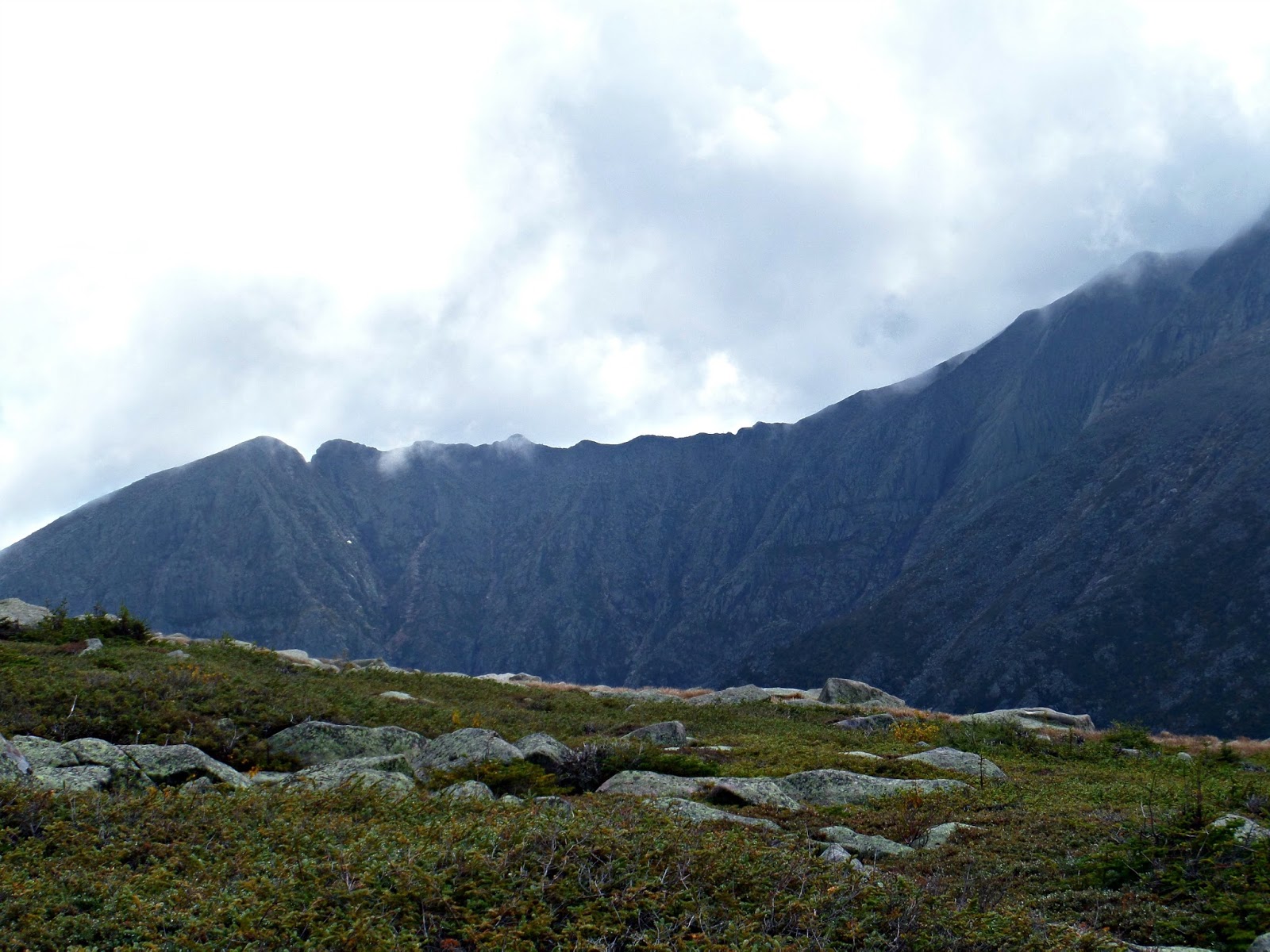
The whole morning we played hide and seek with the mountains. The fog would lift for a few seconds and reveal a section of the park. The sunlight would hit a mountain, field, or lake and draw our attention to a specific feature. There were no panoramic views that morning, but the way the fog swept in and out was beautiful.


There is a rather long bridge that crosses over some very muddy sections that is being worked on. It was neat to see the old sections and the new logs. I’m glad they’re keeping it exactly how it was.


Instead of continuing up to the Chimney Pond Campground, we took the North Basin to the Hamlin Ridge Trail.


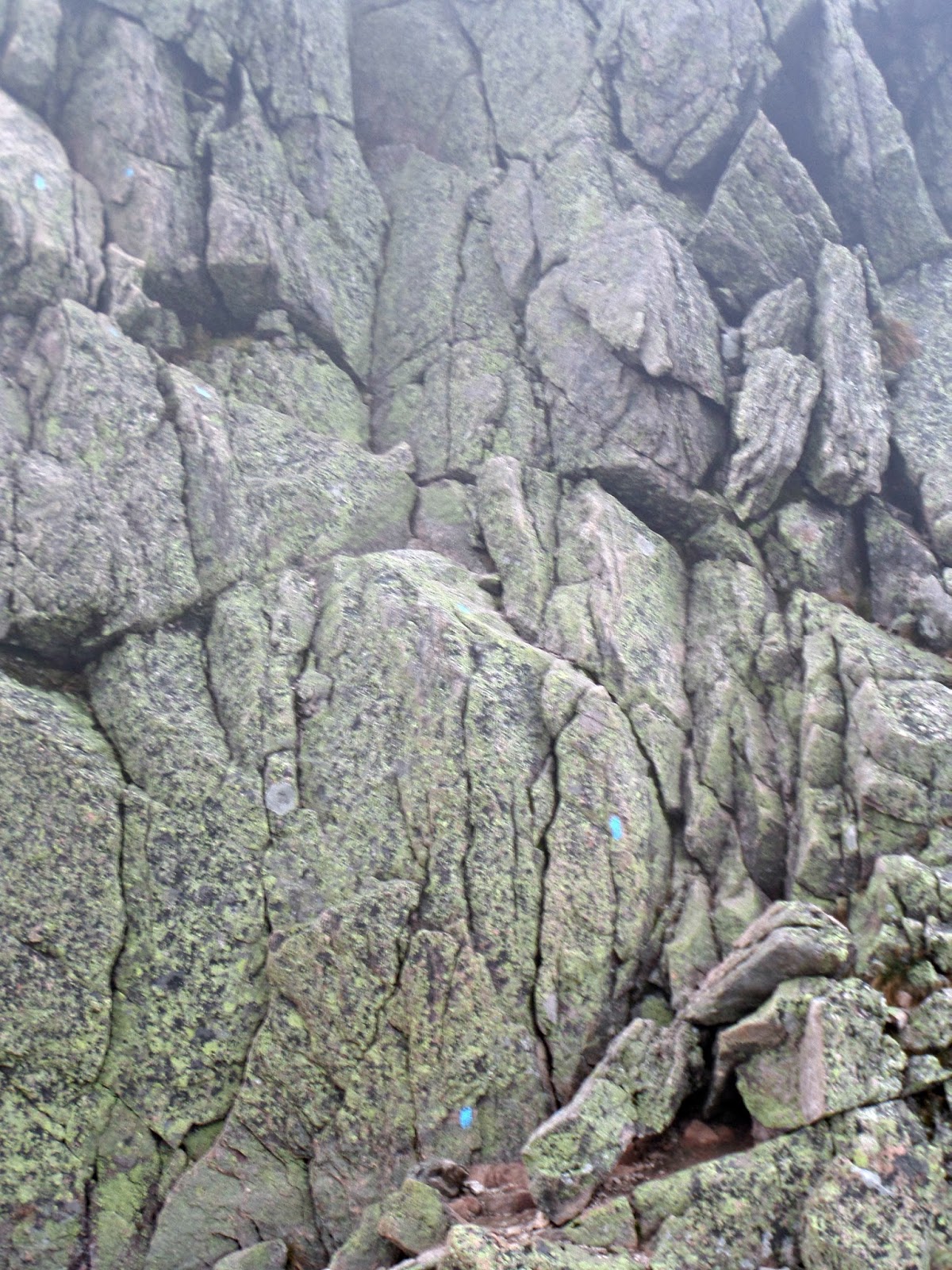
The Hamlin Ridge Trail was a lot of fun and a good challenge. With wet rocks, it was important to have good footing. We noticed that the blazes seemed to be an indicator of where you should be in between and not the route you should directly take. We always had to look ahead to take the best route possible.


As we got closer to Hamlin Peak, the fog began to lift. During a snack break we observed how quick the fog would roll in and out. Would we be out of the fog before Baxter peak?


At one point I went slightly too far to the left when scrambling up some rock slabs. This was by far the most difficult moment on the trail. There was absolutely nowhere I could go, but retrace my route back down and try again. It wasn’t clear from where we stood what the best route was. Every decision on this hike was critical.


Hamlin Peak (4,756′) is marked by a sign listing its elevation and the trail. With the weather this mountain sees, I’m not surprised that sign is almost illegible.


Once we left the summit of Hamlin, we continued on the Northwest Basin Trail. It starts of extremely flat, but then quickly changes scenery. Soon we were balancing over a sea of rocks on what looked like another planet.


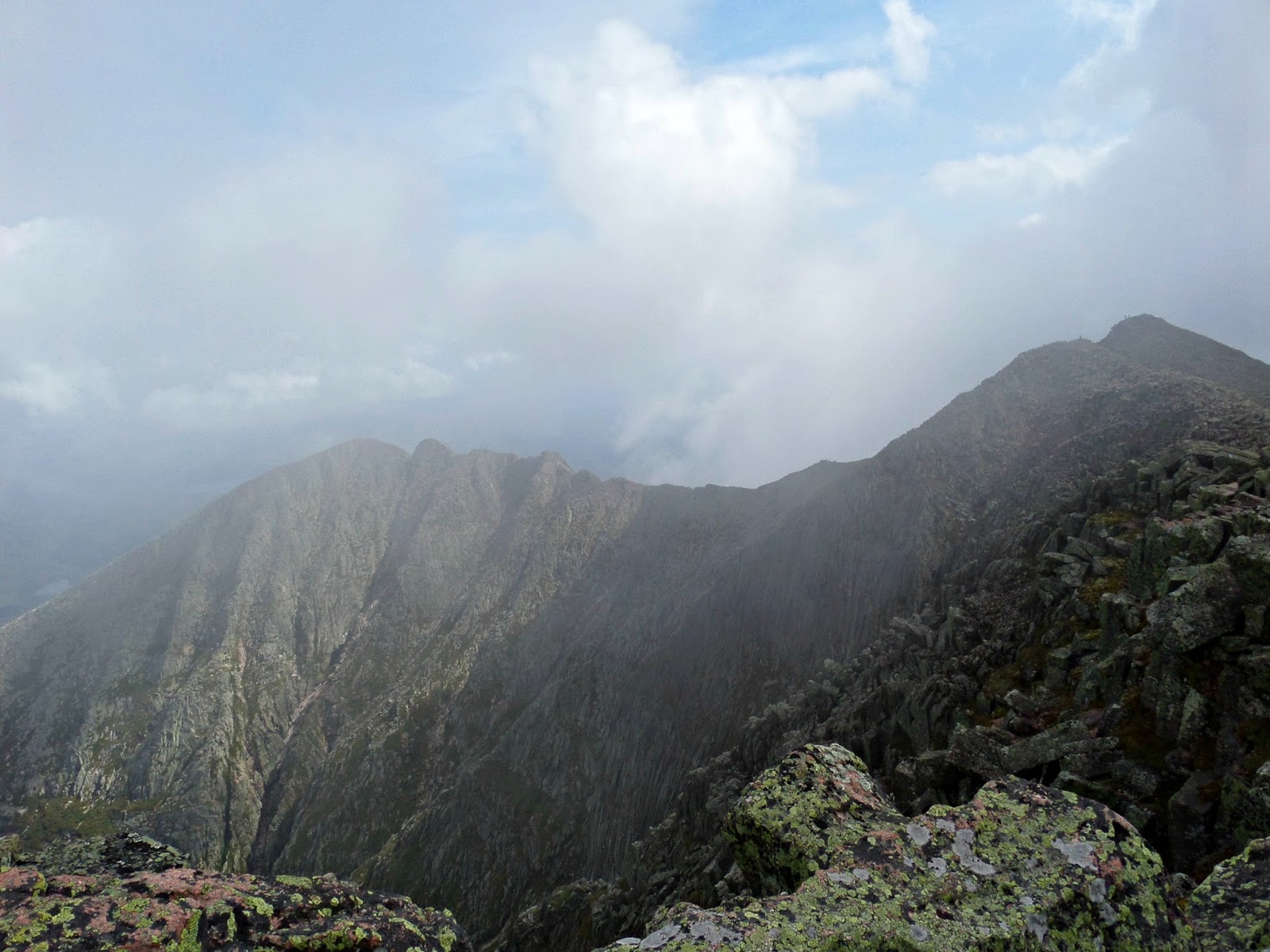
The hike over to Baxter Peak was stunning. The clouds had moved and we got the panoramic views we had patiently waited for.


Baxter peak had a really good energy. It was full of a lot of people who really appreciated being up there.


We hung out for quite some time and had lunch. Our plan was to hike down Knife Edge if the weather cooperated and it was absolutely perfect. As we began to pack up, the number of people atop began to fade. We all really had to use the bathroom but there is no chance of sneaking away on the Knife Edge or really anywhere in the vicinity. Make sure you do this before you get up to Baxter. If needed you may be able to find a spot atop Baxter. Don’t ask how I know this!


 |
| The start of the Knife Edge! |
Mount Katahdin from allison on Vimeo.


Many people hike up the Knife Edge as opposed to going down. I didn’t think this direction was any harder.

From Baxter the trail starts out pretty wide. As you continue, the trail thins out to 2-3 foot wide sections and up rocky terrain. Move slow and watch your footing.


The hardest section is the Chimney. When descending, we came to a section where your foot dangles even when sitting. We had to remove our packs to squeeze into the perfect spot and lower ourselves over the edge to reach a rock for support. Then we were able to lower ourselves down and retrieve our packs.


After we made it to Pamola, it was downhill from there. We would take the Helon Taylor Trail down to Roaring Brook Campground. This trail is rather steep, but I think it is comparable to the route we ascended to Hamlin Peak.


We spent 11 hours and 15 minutes on the trail. That is hike time, breaks, lunch, and plenty of photos. We were on Knife Edge for an hour and forty minutes. I will add in mileage once I add it all up. Also keep an eye out for a video of the hike taken with my GoPro and my North Brother trip report from the weekend!
 |
| It’s starting to look like fall! |
Last modified: November 28, 2014
Excellent report, and so timely as we have this planned for Sept 8.
WOW! I think I just found next summer’s big hike.
Mas será que este Anónimo não vê o ar apatetado do tal Ãlvaro, instável a precisar de uns comprimidos pelo bucho para se conseguir dominar ao mesmo tempo que ri sem ninguém lhe contar piseaa?Ddvia chorar masis a malta que o rodeia porque governantes destes ninguém agora sabe de onde apareceram para destruir a pátria e acabar com os portugueses verdadeiros. Vamos a ver se ainda não cai da varanda como o Vaconcelos.