Last winter I began experimenting with butt sledding. The basics are as follows:
1. Hike up a mountain
2. Find a nice steep section free of rocks or other painful protrusions
3. Sit on something slippery
4. Hope for the best…. and laugh!
I decided to plan an official “Butt Sled Event” where all participants needed to have a sled in order to participate. This way, we were able to sled down and not have to wait for hikers on foot to catch up. The sleds we used were these ones from LL Bean.
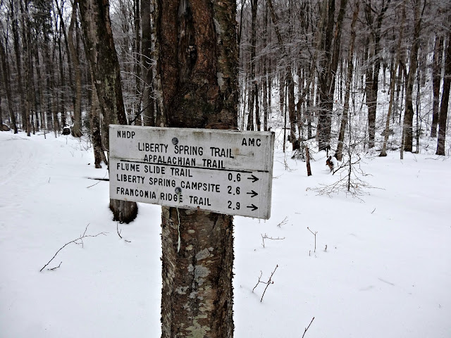
We started at the Basin parking lot to hike up Liberty (4459′) and Flume (4328′). The last time I was on these two peaks was for my all season 4000-footer finish in August. I went up the Flume slide on that hike, but that was definitely not an option this time. We decided on the Liberty Springs trail.
From the Basin parking lot you can take a bike path or do a bushwhack (which we took on the way back) to reach the Liberty Springs Trail. It was nice to have such a moderate start to a hike. My last few hikes haven’t been like that!
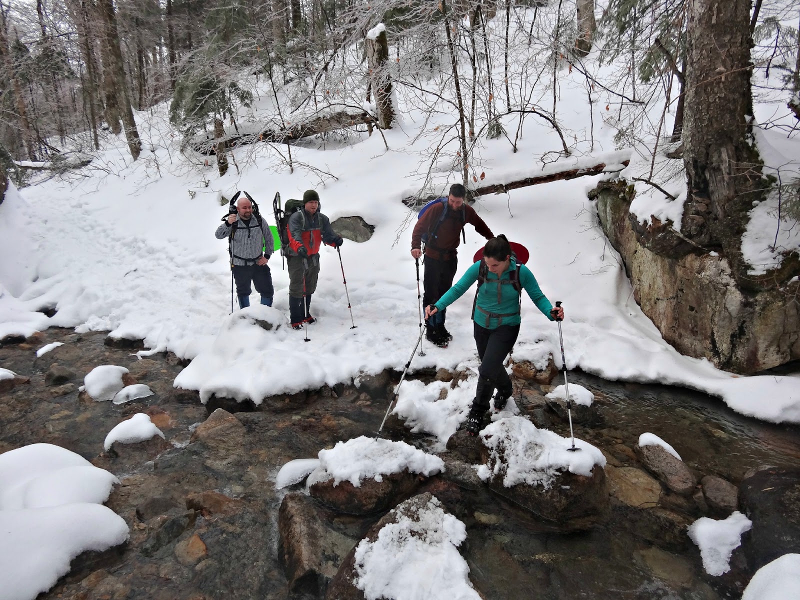
The night before the hike we received freezing rain in the area and the trees were covered in ice. It was also about forty degrees so the branches were dripping on us the whole time we were below treeline. We were convinced at one point that it was actually raining because we were getting pretty wet. Going uphill wearing rain jackets in warm winter weather is a little tricky when it comes to heat management.
After a moderate start the trail beings a steep climb along a series of switchbacks. You will then reach Liberty Spring Campsite (3,800 ft.) on the left and the spring (last sure water) on the right. Franconia Ridge Trail is .3 miles from the campsite. To be clear, this is from the tent sites and not the sign which says that you are entering the forest protection area.
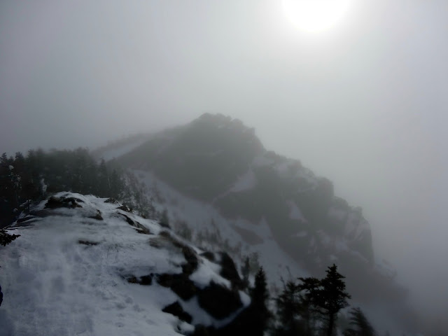
The last stretch up to Liberty was steep, but we could see the sun peaking through which gave us some motivation. The pines smelled so good too!
From the summit of Liberty we got some views of Moosilauke, Cannon, and the Kinsmans when the fogged rolled over. We were very happy to be above treeline and away from drippy trees!
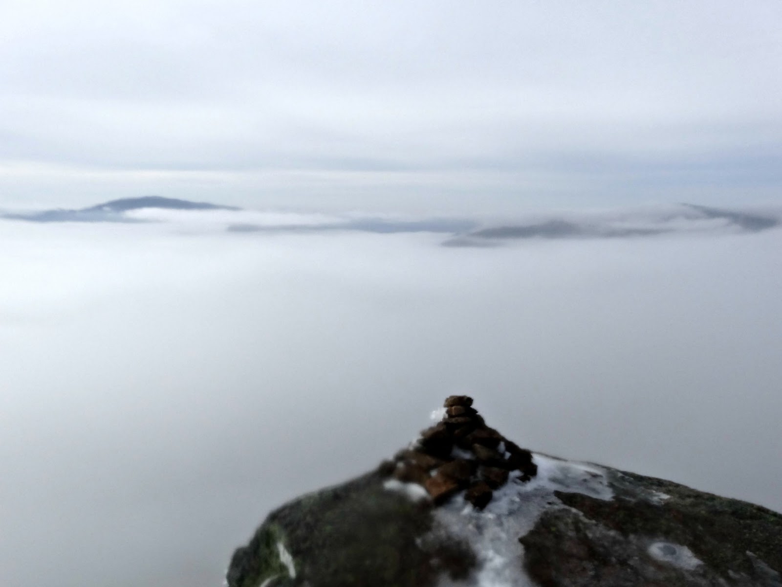
| On the summit of Liberty |
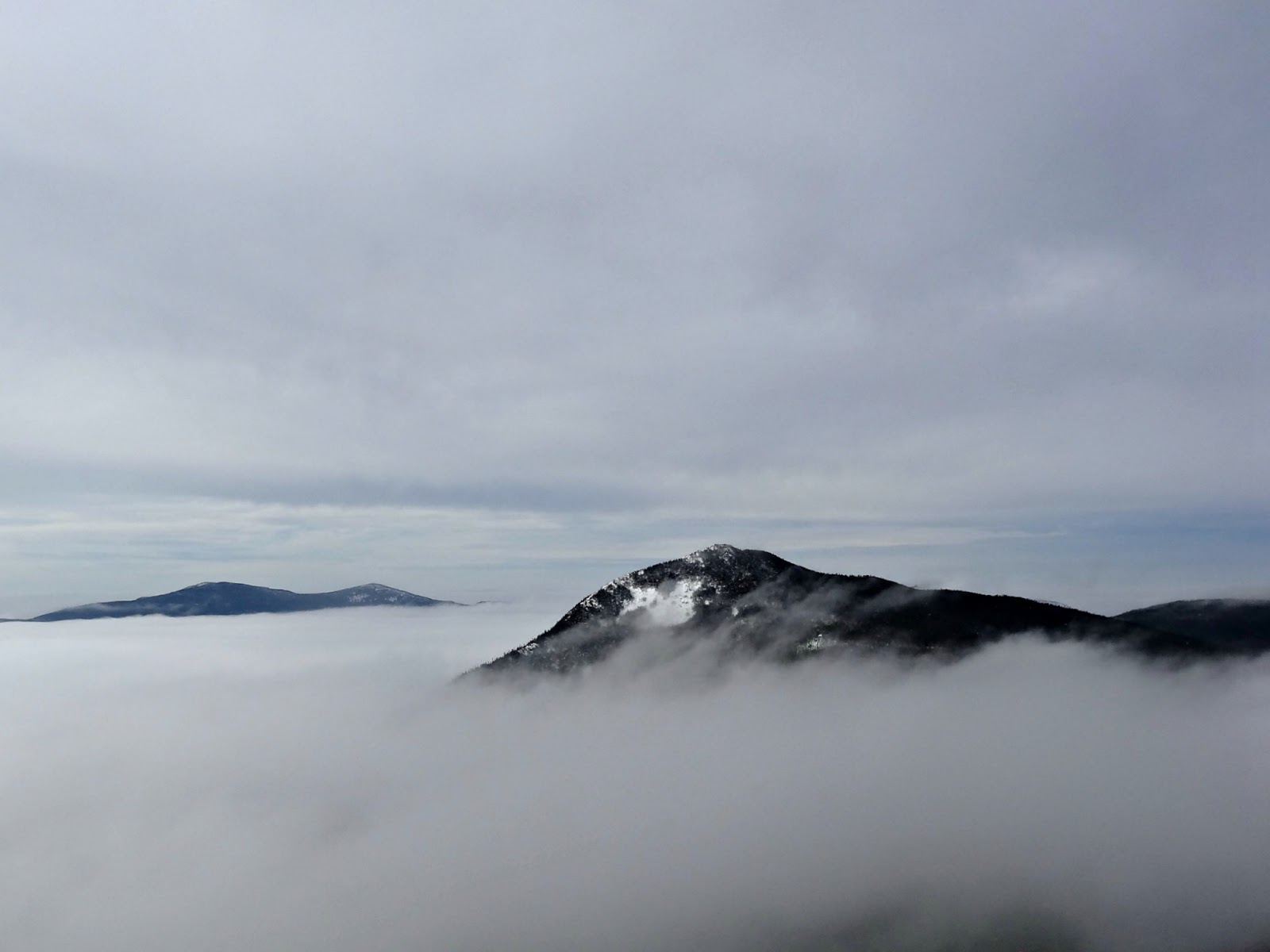
| Saying goodbye to the views until we summit Flume |
The trail between Liberty and Flume is steep. We did a lot of butt sledding on our way to Flume and dreaded the last stretch going back up to Liberty. The hike (or sled) between the two peaks is 1.2 miles and is well worth it to bag Flume as you also get terrific views from this peak.
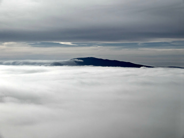 |
| View of Moosilauke |
This was a really odd weather hike as it had been really warm (35-40 degrees the entire day with very little wind). It had been warm the whole week, but the trails were packed really well. I brought my snowshoes, but didn’t need to use them at all. There was a mix of people wearing either snowshoes or microspikes. My group all wore spikes.
This range has some of my favorite views and has some awesome sledding opportunities. We made it to the flats of the Liberty Springs Trail in an hour. On our way back to the cars the bushwhack was very obvious and really packed out so we took that back. If you’re looking for good views, both peaks are bare summits!
Quick Facts:
Approach from: Basin parking area (bike path to Liberty Springs Trail
Height: Flume: 4328′
Liberty: 4459′
Distance: ~10 miles
Elevation Gain: 3270′
Time: ~7.5 hours
Last modified: July 13, 2017
Mike and I should have waved to you from Moosilauke! Looks like you had a good hike. 🙂
Thanks for the suggestion Allison. The upper half of Liberty Spring Trails had really good sledding conditions today. Was quite fast and a lot of fun.