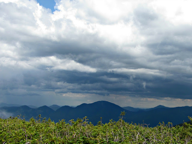
The hike started out to be moderate as we expected. We climbed around 1850 feet in 2.5 miles to the summit of Mount Hale.
| Mount Hale |
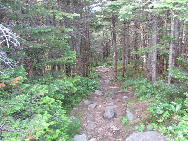
We continued on down the Lend-a-Hand trail, which was a beautiful area. Here and there you can see some nice views of the Presidential Range. The area was so lush and green at some points, too.
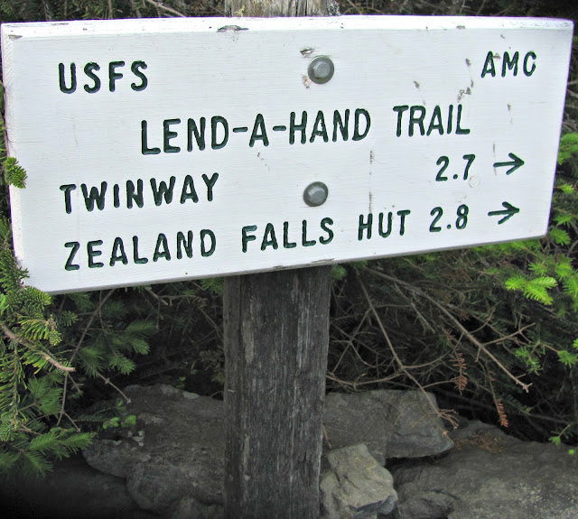
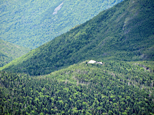
You will approach the Twinway junction which is near Zealand Hut. We headed up towards Zeacliff to see some great views. This outlook is the cover photo of Steven D. Smith and Mike Dickerman’s book
The 4000-Footers of the White Mountains. My favorite resource!
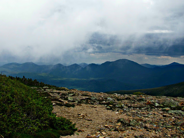
The next mile to Zeacliff is steep, but it’s so worth it. On a clear day, you get the most amazing views into Zealand Notch and Carrigain Notch.
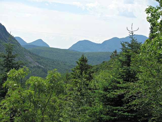
The view of Carrigain Notch: On the left are Mounts Lowell and Anderson and on the right is the Vose Spur with the ridge up to Carrigain. You also get a nice view of Whitewall Mountain.
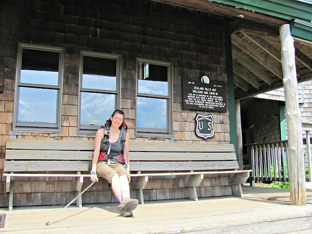
Time to check out the hut! They sold homemade cookies and lemonade along with some other treats. Make sure to have an extra bottle to fill up if you want to buy lemonade!
The view from Zeacliff is excellent. You can see Zealand Notch to Whitewall Mountain. Further in the distance the Willey Range and the Presidentials are in sight. You also get a nice look at Carrigain Notch from a unique angle and part of the Pemigewasset Wilderness.
| Feelin’ strong! |
The trail to Zealand passes a junction with the Zeacliff Trail on the left then ascends over several ledgy humps and then crosses a side path that leads off to the left and descends to the shore of
Zeacliff Pond. The main trail continues up a steep pitch with a ladder to help you over a ledge overlooking the pond. The last leg of this trail becomes more moderate as you approach the wooded summit of Zealand.
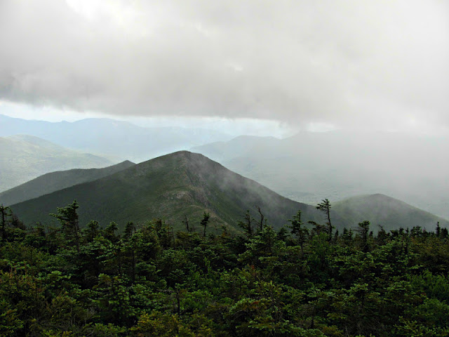
After we reached the breathtaking views of the Zealand sign, we began up with some rough footing the long ridge to Mt. Guyot (not an official 4k), breaking into an open ridge before reaching the summit.
When we reached Zealand, we could hear thunder in the distance. We felt a little rain so we put our pack covers on to be on the safe side. The pack covers are a little easier to deal with in comparison to lining your pack, but in the wind it can parachute out.
After almost ten miles, we reached the sign for the Guyot campsite, where we would be spending the night. We began to quicken our pace to make it before any rain.
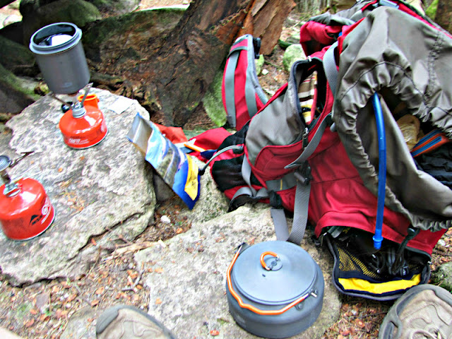 |
| Dinner Time! |
Once we made it to the campground, the weather began to turn, but it wasn’t too bad. We were surprised by how busy it was as the weather report wasn’t that fantastic. We had a couple choices for sleeping. We could stay inside the shelter, share a platform, or pitch a tent in the overflow area.
The shelter was pretty hot and the only spot was under a platform. It was also filled with many (probably soon to be snoring) men. I was all set with that. Anne and I decided to share a tent platform with another couple. We shared a two person backpacking tent that I own and the couple we shared with had one as well. We had enough room and could secure our tent and also enjoyed their company during dinner.
A couple members of my group opted for the overflow area. It is further away from the bear box and water source, but also away from any noise and closer to the trail without being directly on it. That was probably the best option.
Mt. Bond ended up being pretty wet. As we hiked toward Bondcliff, we were cautious to always be aware of the thunder and to be open to turning back if need be.
The Bondcliff Trail was a little wet, but gorgeous! The trail leaves Mt. Bond into a scrubby wood about halfway down. The trail then reaches the open ridge into a long, flat col. The trail is above treeline for about a mile so hiking in thunder would not have been an option. We did stay on the left of the edge of the ridge which seemed to have better footing.
I was so excited to reach the summit of Bondcliff. I have heard many hikers attempt to explain how beautiful and wild this summit is. I knew the only way to truly know would be to get out there!
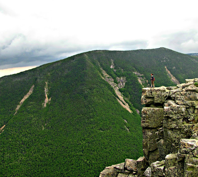 The cliff was definitely a highlight of the trip. From here I couldn’t see anything but wilderness. And I loved it. I of course had to do the famous pose atop Bondcliff even with the wind rattling against my rain jacket.
We left Bondcliff at a good time. The hike over to West Bond was long, wet, and a little painful. At first it just began to rain. It then turned into a heavier rain and then hail. The hail was small, but sharp. I was covered except for my face which was stung by the little shards of ice. Once we got to West Bond, a few of us got a summit shot and hopped on down back to Guyot. We had warm clothes and sleeping bags to get back to!
The hail did make the hike quite the adventure! It did slow us down and we were rewarded with the sunset we were hoping to see.
After a descent night’s sleep (for some of us) we had breakfast and packed up. The destination of the day was South and North Twin and back to our cars.
From the Guyot campsite we immediately hiked up 300 feet. What a way to start your morning! Once we got to the junction of Mt. Guyot, we swung right onto the Twinway. This section was a really moderate hike into the scrub. This was nice for day two. The hike was a long, fairly gradual climb toward South
Twin. You do have to do a little work for the 360 degree views atop South Twin by ascending a short
steep pitch up the cone.
| The many views from South Twin |
To reach North Twin, you leave the south knob of South Twin and then descend moderately to a fern-filled trail and then begins to ascend the col. to North Twin. At this point we were approaching our last peak of the traverse. The North Twin Trail continues straight ahead and a spur path leads to the left (60 yards) of the summit to a beautiful outlook.
When we reached the summit, one of the guys in the group pulled out a flask of Captain Morgans he kept in his pack for two days. I was impressed that he was able to keep it a secret and not drink it before that point in our hike! It did give us a nice little boost for the last leg of our hike.
From the summit the descent becomes quite steep. We were glad we didn’t come up this way! The trail crosses and recrosses a tributary brook. It descends toward the Little River, eventually crossing it. The three crossings of the Little River on this trail are very difficult or impassable at high water. the third is said to be the least difficult. We avoided the first two by following a heard path along the river. This path eventually meets back up with the trail making its way to the North Twin Trailhead.
At the end of the hike I had a new appreciation for the area I live in and the people I hike with. I could not have had a better group to share this adventure with.
Last modified: July 13, 2017
What a great adventure, thanks for sharing your experiences. My daughter’s class did a much shorter 2-day hike into the WMNF in June, she absolutely loved it. Congrats on your accomplishment.
Thanks Allison for the wonderful account of your trip and the photos. I am reading this from the comfort of my couch, as I was supposed to be waking up at the Guyot campsite and finishing the 48 on Bondcliff this morning. Having spent Thursday night at Zealand Falls Hut the weather report Friday morning turned me back. Though it felt like quite a failure, it would have been a miserable wet cold night at Guyot with no sunset view from West Bond and most likely a socked-in finish on Bondcliff. Not exactly what the master plan called for. Thanks again, I live vicariously through your report !
Allison do you use a polarizing filter? Your pics are great.
Thanks Mazzachusetts! I just have a regular point and shoot. I try to fool around with settings when I can. I’d probably break a DSLR 🙂