
A hike always begins with a look at the weather forecast. I would be hiking solo so I could be very flexible. It was supposed to rain in the morning so I decided to go for a later start.
The next morning the weather reports changed to afternoon rain… and possible t-storms. I had planned to ascend the Tripyramids via the North Slide. I had two hours on my drive up to make a final decision on my route. I could always hike up Sabbaday Brook or Pine Bend Trail instead. I really wanted to revisit those slides. When I was close to Waterville Valley I looked up the weather again and it said clear skies. It was the best day we’ve had in weeks. The slides were a go!
Before ascending North Slide, I began at the Livermore Trail. It is mostly flat and was a beautiful vibrant shade of green. It was a beautiful start to my day. Even the ground sparkled from all the mica!
After over three miles of flat trail, I was ready for some vertical.
The beginning of the Mount Tripyramid trail was where the fun began. I wore my Vibram Five Fingers for this hike. While I don’t wear them on some of the more rocky 4ks, I thought they’d be a good fit for the slides. Then I arrived at the mud pit. I attempted to navigate my way around and find dry rocks to amble my way across, but each “rock” turned out to be a sinking pile of moss and each branch was decayed and slowly sank under my weight. There was no way around. It was a good thing my Vibrams dry quick!
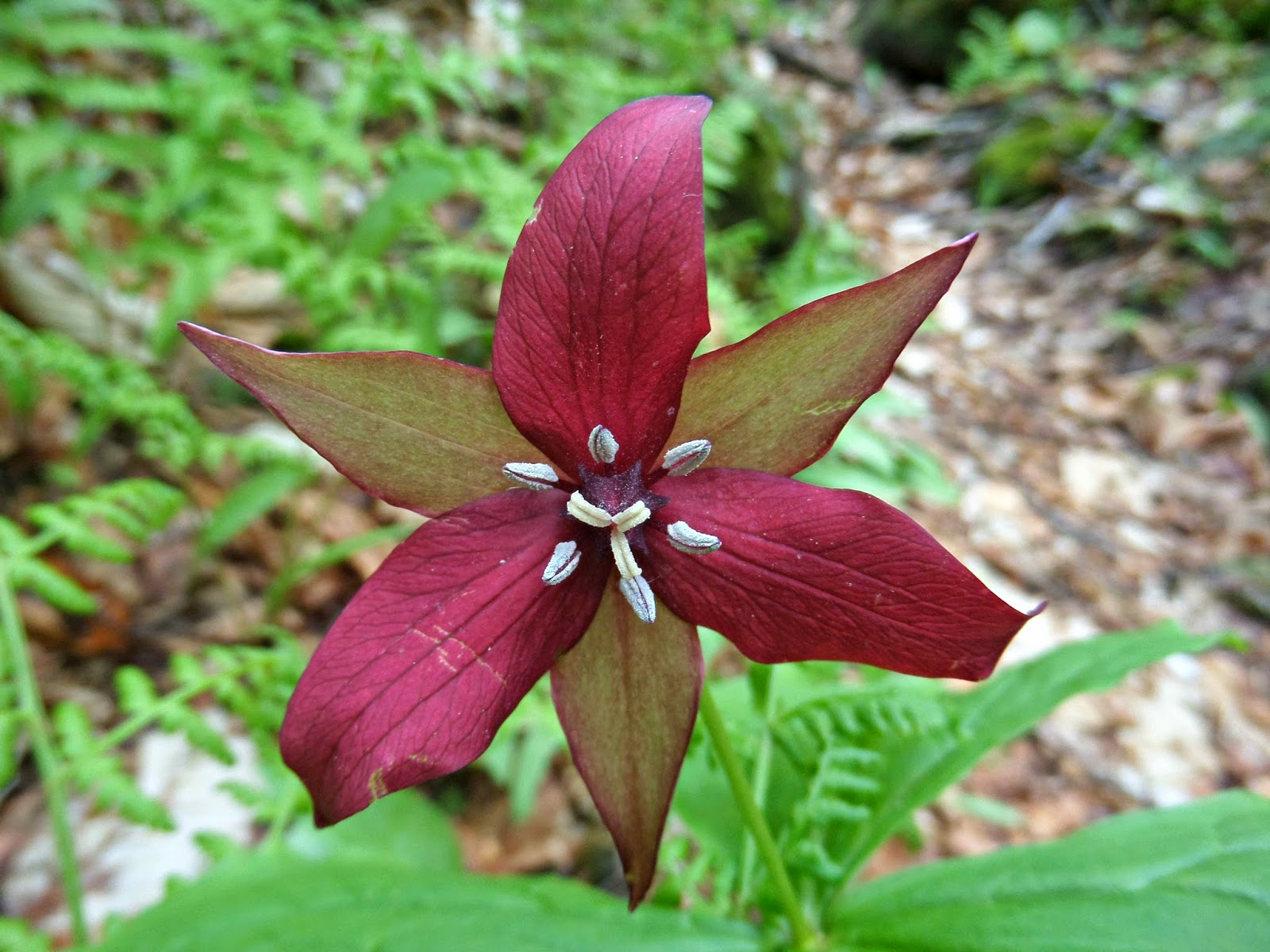
After my failed attempt at gracefully navigating through the swamp, I was flanked on both sides by poison oak (?? picture below). I have never had a reaction to any plant, but I wasn’t taking any chances!
Soon enough I escaped the woods and its gnats, mud pits, and poisonous plants. I was ready to go up.
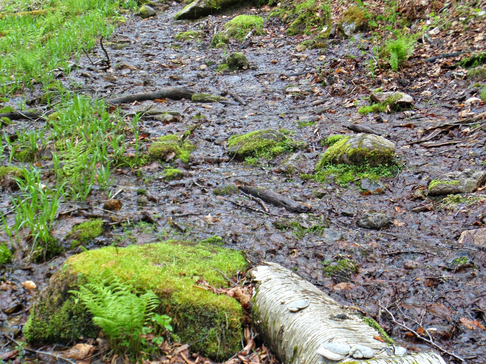
 |
| The very sad looking start to the slide |
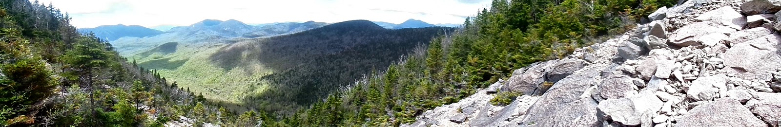
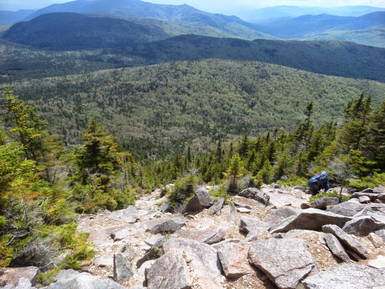
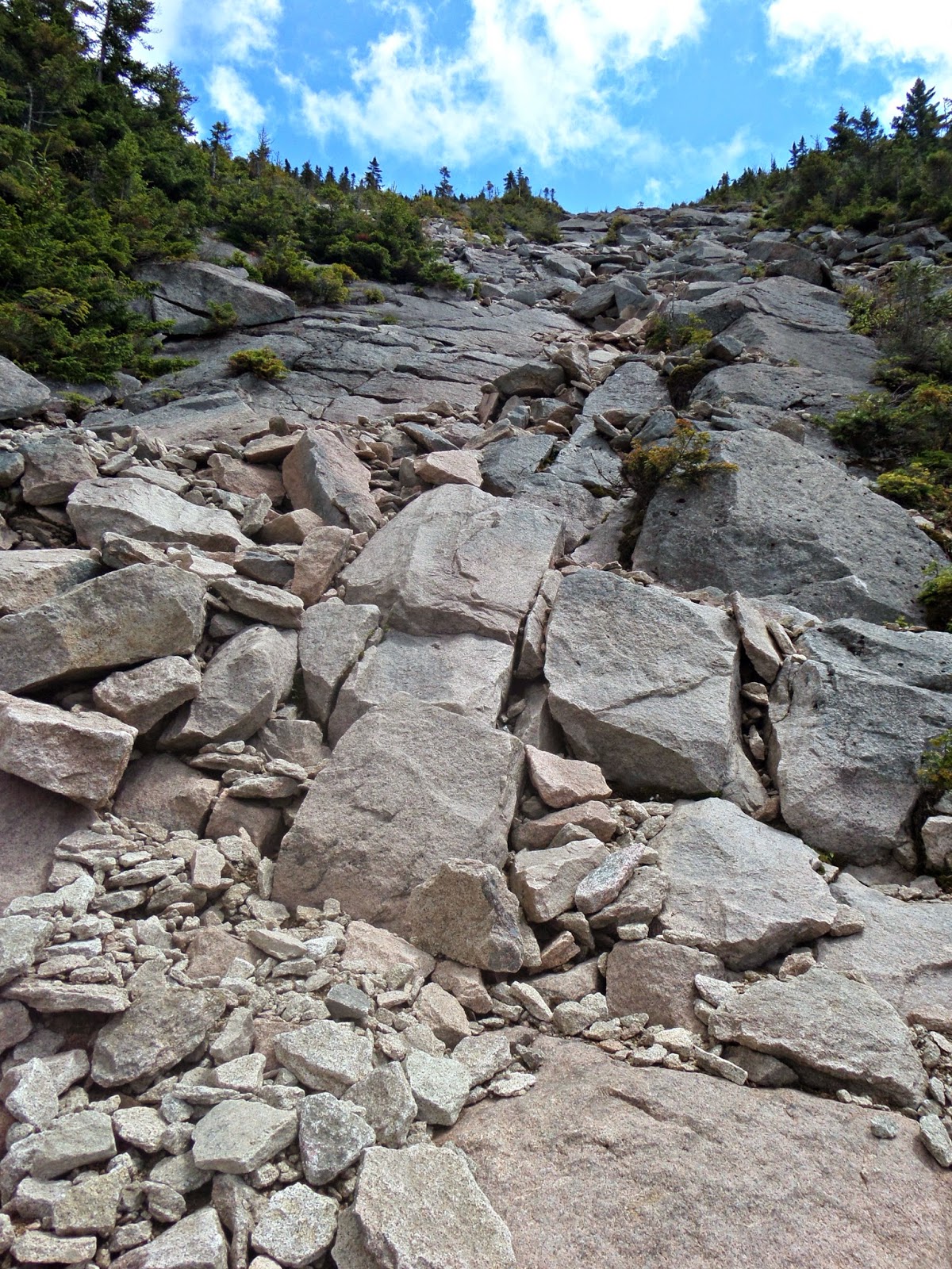
The North Slide is 45 degrees and consists of a mix of scree, boulders, and large rock slabs. It is pretty shaded so you are likely to encounter some wet sections. The White Mountain Guide warns hikers not to ascend if the trail is wet. Last time it had been a little wet on the slides so I knew what I was getting myself into.
It turned out to be an absolutely gorgeous day hiking under a bright blue sky. That is, until it began to rain.
All of a sudden a giant cloud rolled in and large rain drops began to fall. I quickened my pace and made my way closer to the right side of the trail. Only a few dozen more feet up the slide in the rain.
As I approached the top of the slide, another female hike took a spill. She was ok, but I soon found out the pair had lost the trail and returned to a familiar spot to gain their bearing. I pointed them in the right direction (to the left) and they were on their way again.
At the summit I had some jerky and then an almond butter cup. It was the best pairing! Down the trail I ran into the two women from earlier and talk for a few. I continued on the trail and as I was approaching Middle Tripyramid, I saw a man with a Dunkin Donuts poncho and leopard tights around the bend. The two were planning on staying overnight and then hiking Whiteface and Passaconaway the following day. Despite their heavy packs, they were going at a good pace. Maybe it was the tights. I hiked with them to East Sleeper.
After South Tripyramid, we began to descend South Slide. They asked where the Kate Sleeper Trail could be and I knew it was part way down the slide from a fellow hiker (thanks!) so I told them to continue down and look to the left. It was an obvious trail and even had some yellow paint on a rock to mark the entrance. The trail takes a turn and descends even further down. I just kept thinking about how I was supposed to go back this same route.
| Enter the Kate Sleeper Trail on left |
As I continued toward East Sleeper, I encountered the last remnants of winter.
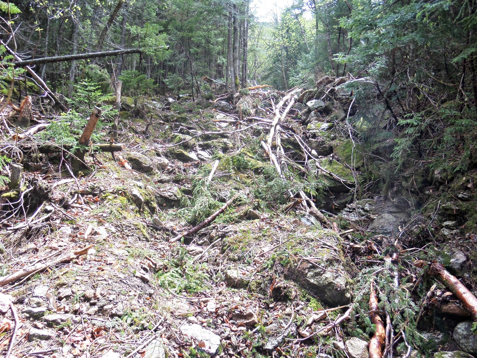
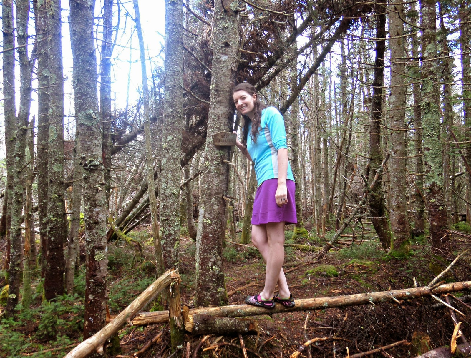
As long as the giant blowdown (shown below) isn’t moved, the true summit of East Sleeper is easy to find. Just hop over and follow the sign!
I sat on a log and contemplated my descent. I knew what I would encounter going back to my car via South Slide. Looking at my map, Whiteface wasn’t too far. It was a little over two miles and I could descend via the Blueberry Ledge Trail. I had come up that route before. My decision was seconded by a man in leopard print tights.
I quickly arrived at the junction of Rollins and Blueberry Ledge. There was plenty of daylight and I was itching for more, so I took a left and headed toward Whiteface.
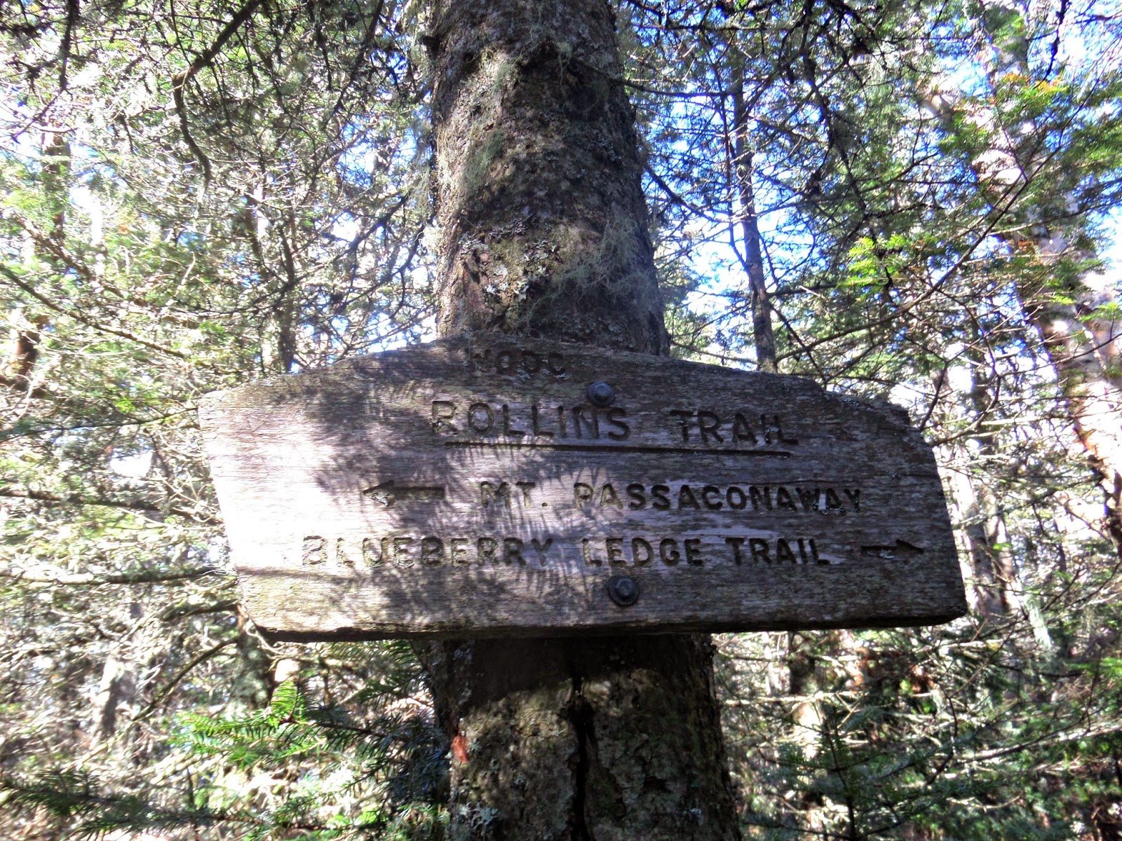
I hustled up Rollins Trail to the wooded summit of Whiteface. I remembered from my previous visit the number of ups and downs before you reach the true summit.
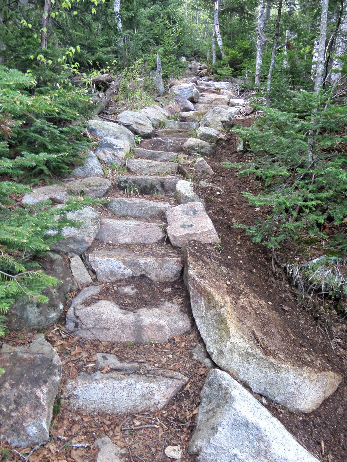
The descent was a lot of fun. I got to see some more amazing views, make my way down some more rock slabs, and listen to the birds sing.
19.6 miles and about 7000 feet of elevation gain and I’m done! Totally not what I planned, but exactly what I needed.
Last modified: September 2, 2017
What a great post, loved reading a seeing photos of your adventure! I live in NYC and this is inspiring me to travel a little further to get in some more elevation and beautiful views! Are you hiking the JMT this summer? My sister and I set out from Yosemite Valley (Happy Isles) on August 4th. If you’re going, hope to see you out there!
Awesome blog post. I hiked Hedgehog Mountain this weekend, and am in the process of planning for Passaconaway and Whiteface…Thanks for sharing!
Congrats on a great hike through the Sandwich Wilderness! Great report and Pictures!
Thanks everyone! Whit and Ash, I will be starting July 25th and aiming for 16 days. Starting at Happy Isles as well. I’ll wave to you when I finish 🙂
Great report - looks like an awesome hike!
GREAT ARTICLE AND PHOTOS TOO
GUTSY OUTING FOR A PRETTY GAL TO BE OUT THERE ALL ALONE
I appreciate you reading but not the sexist comment. Women should be free to do these types of hikes without judgement- HYOH.