Scar Ridge is a notoriously difficult hike. It involves navigating through thick brush without a maintained trail to guide you. The goal is to reach West Peak on this long, viewless outing.
So if there is no view and no trail, why do people hike it? A list. There is always a list. In Spring of 2011 I began working on my NH 4000 footer list which I became infatuated with and completed in a year’s time. The following year I hiked the 4000 footers in Vermont and Maine which when added to the NH 4Ks, make the New England 67 list. I then became a little obsessed with the New Hampshire 4000 footers and hiked them in every season. Yup, 48×4= 192. Obsessed.
It was when I was attempting to begin a new list- the New England Hundred Highest- I hiked the 4Ks in every season. I began checking off peaks while pairing them with 4Ks. For example, the Sleepers were hiked in conjunction with the Tripyramids, Whiteface, and Passaconaway. I wanted my views, my familiar trails. I wasn’t quite ready to move on. And frankly, I was a little scared.
The New England Hundred Highest list is a bigger commitment. It often requires long drives to more remote areas like the northern end of Baxter State Park and the Maine/Canadian border. It also requires bushwhacking and hiking not for the views or external rewards.
When I completed my four season 48 list this past winter, I decided that I was ready to move to continue with the Hundred Highest list as I was actually mostly done. The problem was most of the peaks left were the hardest to do.
I had been researching Scar Ridge for a long time. I had the gear, the data, and I believed the right mindset. I wanted to go for West Scar. Solo.
Scar Ridge starts off Loon Mountain’s North Peak. It begins with a herdpath off the Upper Walking Boss ski trail. This means hiking up green, blue, and black diamond ski trails. Take it from me: ski trails are not meant to be hiked.
I told myself to remember to look back at the views as I knew these would be the only ones I’d have all day. It was easy to do as breaks were frequent on this steep ascent!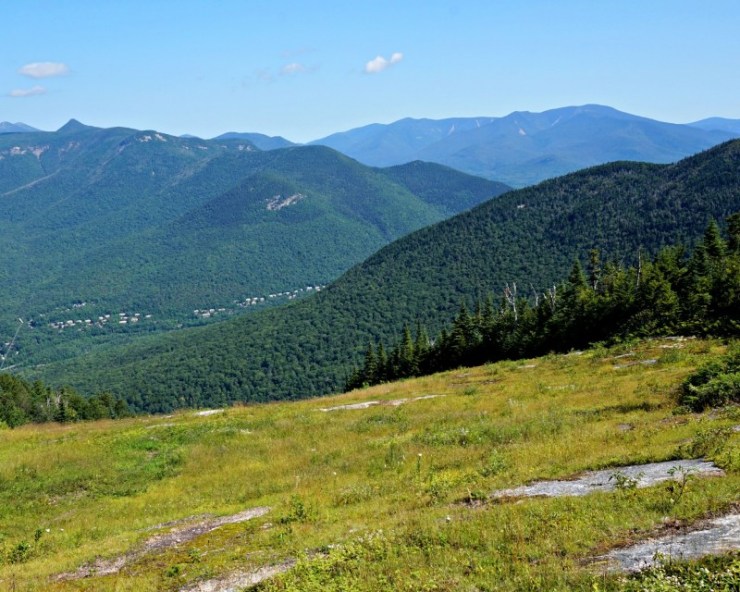
There are two out of bounds signs for skiers. At the second (below the ski lift t0 the left) is where the herdpath begins. It is also marked by a cairn.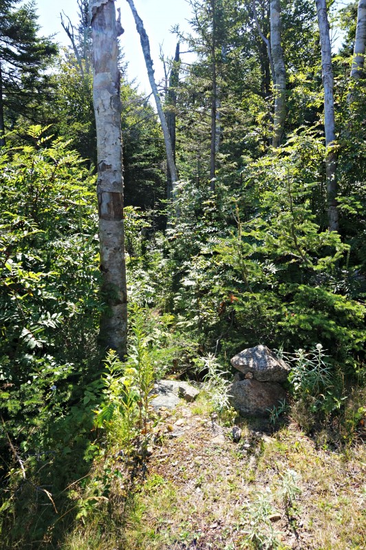
The herdpath is easy to follow and actually was nicer than some of the maintained trails I had been on in the White Mountains!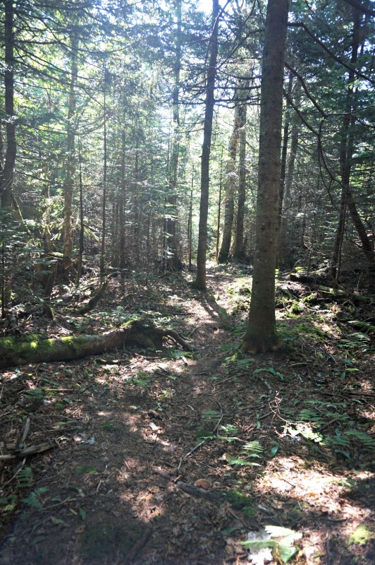
Even though hunting season does not fall in August I still wore my blaze orange. I like to do so when hiking off trail in case there is someone hunting or for much higher visibility if I ever needed a rescue. I also wore my fantastic 50’s style bushwhacking glasses. I know you’re jealous!
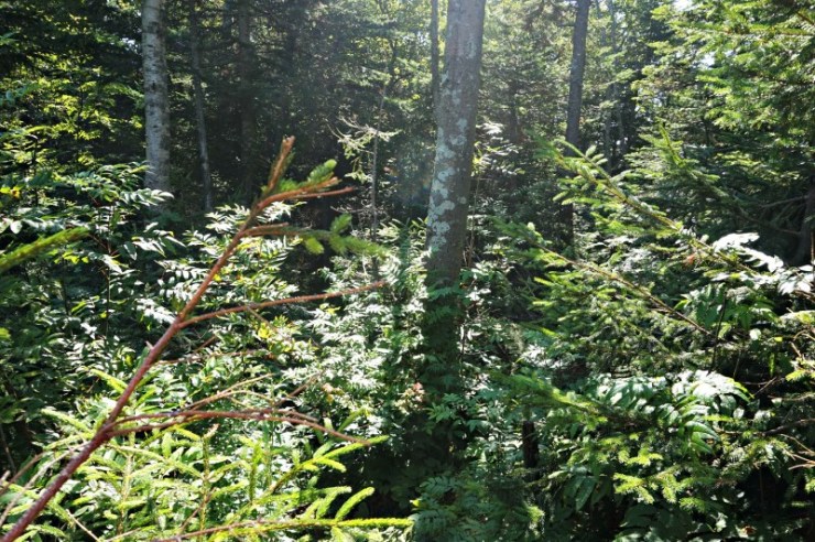
The herd path lasts only 6/10 of a mile before the bushwhacking begins. For me it really took some time to get a good route going. I zigzagged often trying to find a path of least resistance while heading in the correct direction. There are a few resources online with more route information and even GPS routes. You can find that on your own- it’s part of the process! I went sans technology relying only on my map and compass.
I made some friends along the way. I highly recommend you stay aware of the ground and ahead of you as there were about a dozen intricate webs throughout my hike, many of them made by very colorful (and possibly dangerous) spiders. Keep your mouth closed too; spider webs don’t taste very good!
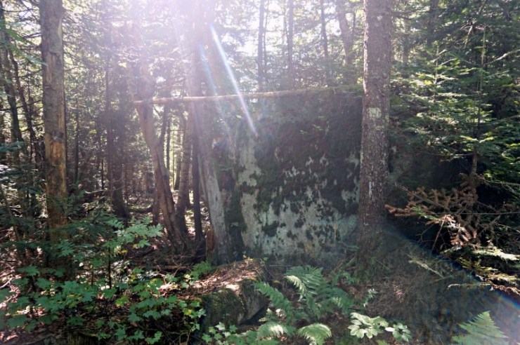
Finding my way to the summit took some time and patience. When bushwhacking you can be as slow as a 1/4 mile and hour and maybe up to 1 mile per hour at your fastest. All your hiking expectations can go out the door. I highly recommend you keep track of your pace to make more informed decisions as you hike. I almost reached my set turn around time when I reached the canister.
From the trip reports I’ve seen online, it looks as though a new canister has been placed at West Scar! I was happy to have made it, but once I got here, the real challenge began.
I often hear of hikers making mistakes and lying about it online. Instances have included unplanned overnight stays on the trail, dropping all their gear and losing the trail back to it, or putting people’s lives at risk with poor decisions. New stories are made up to cover up these details. Lines like “it was so fun we decided to hike it the next day!” are typed out. Mistakes are to be learned from and if you are publishing something on the internet for others to read (even if it is just on facebook) you better be honest.
I like to be as transparent as possible. If this kind of hiking were easy, everyone would be doing it.
After reaching the summit of West Scar I took out my compass, found my bearings, and began to hike down. Not too long after I followed a path made by a moose. No encounter, but tree scrapings and scat. At that point I got pretty disoriented and had to make a decision.
I thought about the route I took to get to the summit and how difficult it would be for me to find again on my way back down. I thought of the sharp turn I would need to make to continue onto the bushwhack as well as the turn back onto the herdpath. What if I couldn’t find them? I took out my map and studied it hard. There was so much forest surrounding Loon Mountain. There were mountain bike trails and Ponds. What if I couldn’t find that turn partway through the bushwhack? Would I make it out of the woods tonight?
I made a difficult decision: I would navigate North to route 112. Now we are always told to stick with our original plans and not to head off trail. I was already off trail and wasn’t sure I’d ever be able to make it back to my original plan. I couldn’t tell really how long the hike out would be or predict what the woods would be like. I did know that if I stuck North I’d make it to the road. No tough turns to make.
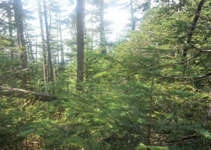
The route started off fine but got thick quick. Bushwhacking is both physically and mentally difficult. You must navigate as you go constantly checking your route and be completely aware of your surroundings. You must make sure every step is safe. Off trail there are many rotted logs and dead branches. You have to be sure everything you step on will hold your weight. You must hike through heat and bugs and branches. There are so many branches. You must cover your eyes and your ears to be sure you aren’t poked. You can’t always make this happen. You must stayed hydrated and remember to eat to keep your mind sharp. You can’t just focus on getting out.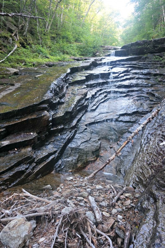
As I hiked through this untouched forest I hoped to stumble upon something unbelievable: parts of a single engine plane, a hidden box of money, the answer to an unsolved missing person’s case. Just trees, rocks, and eventually water. Oh well.
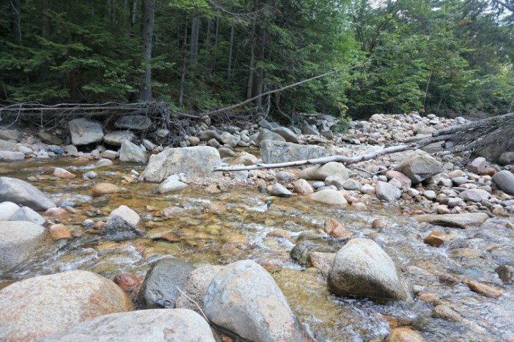
I followed part of the Hancock Branch downstream, often hopping to the brush beside it when it looked to be a faster route. In reality none of it was fast. Lately there had been a few stories of deaths in the White Mountains. One involved a hiker rock hopping. I walked in the water as many of the rocks were slick with algae. At times I’d wade up to my knees just to be safe.
On occasion I could hear the road and wished more motorcycles would pass by. Typical traffic was muffled by the river and was impossible to tell how close I was. 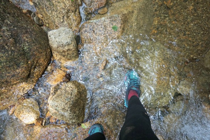
Eventually I had just one crossing left. I picked my route and made my way safely across.
Though almost an hour and half past my planned ending time, I made it to the Kancamagus. I was thrilled to see road. I crossed the road, stuck out my thumb, and soon after got a ride from a southern couple on vacation with their five kids. Off to Loon Mountain I went.Making the decision to hike to the Kancamagus probably got me out of the woods that day. I couldn’t tell you if that was the right decision as I don’t know if I would have been able to orient myself after following that moose path and get back to the ski area. I had enough to spend the night, but also had a good head on my shoulders to get out safely after ten hours in the woods.
Hiking is never easy. You always have new lessons to learn and will be humbled by the trail. I hope this hike, while successful, gets you thinking about your own preparations, skills, and how you would get yourself out of a similar situation. Stay safe out there!
Last modified: September 1, 2017

Great post. It’s not everyday you read something like this. I don’t bushwhack but it’s a great message to all hikers. I think we all take the trail granted from time to time and this is a nice reminder.
Wow. Sounds like a hard hike! It’s refreshing to read about a hike not going completely to plan. It makes me feel better about having to turn around or some of the mistakes I’ve made on hikes. No matter how much you hike it seems like you still have more to learn. THANK YOU for this!!
I love your honesty and your ability to make such a good decision. Hiking without technology deserves much respect! This is how it should be done! I applaud you!! Awesome article.