This trip was part of a 3 day adventure in Northwestern Maine, bagging six trail-less New England Hundred Highest peaks. Read about my hike to White Cap and North Kennebago or Cupsuptic Snow and Elephant Mountain.
Day 2- 9/7/2015: Snow Chain of Ponds (3690’) and East Kennebago Divide (3784’)
Hike 1: Snow, Chain of Ponds
Trail Data: Snow- Chain of Ponds: 7 miles, 2200’ elevation gain
Hiking: ATV trails, herd path,
Directions to trailhead- COP Snow:
North Road, Eustis (off Route 27 approximately 10 miles north of Cathedral Pines Campground). Take left onto North Road, and then right at the “Y” intersection. Cross bridge. At 2.3 miles bear left and cross bridge. Pass Sports Camp Road on the left, cross bridge and bear right. Parking lot is at the end of the road (just under 5 miles from the 27/North Road intersection).
Note: Earlier reports mention a change to the approach. The only change seems to be the hike on the ATV trails to get to the herd path. You will begin the hike on this “ATV road” which now has a “No ATVs allowed” sign. That seems to be the only difference.
Hike:
There is plenty of room at the Chain of Ponds parking area. At the end of the parking area there is a trail previous reports had called an ATV trail. The Penobscot Nation Tribe made some changes and now there is a sign that says “no ATVs!”
The trail is wide and climbs moderately. You will cross 3 ATV bridges.
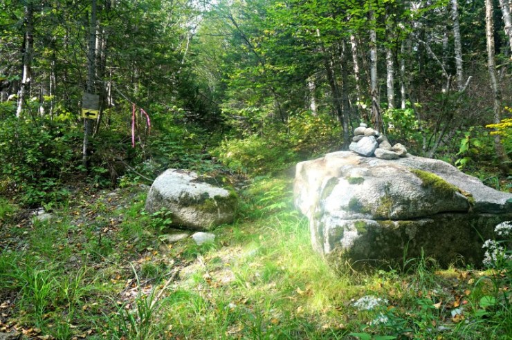
You will come across a yellow sign with an arrow pointing left where the trail curves. You will instead hike straight between two large rocks. There is a small cairn on the larger rock.
The path turns into a stream bed. Follow this for a few minutes. You will pick up another ATV path on the right.
The path will enter a four-way intersection. Continue straight through the intersection.
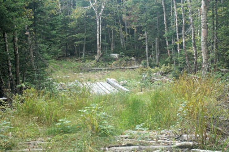
You will see a bridge on your left as you walk through the intersection.
You will then arrive at a large rock with a broken yellow sign. Both halves are on this rock. Follow the herd path on the right.
The herd path will end and you will go left on a logging road. This trail begins to ascend moderately and then it is very steep.
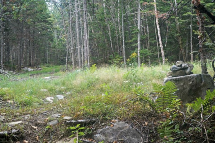
Eventually you’ll come to an intersection (could be seen as a “T” or “Y”!) Take a right here. The herd path is marked by a small cairn which leads to the summit.
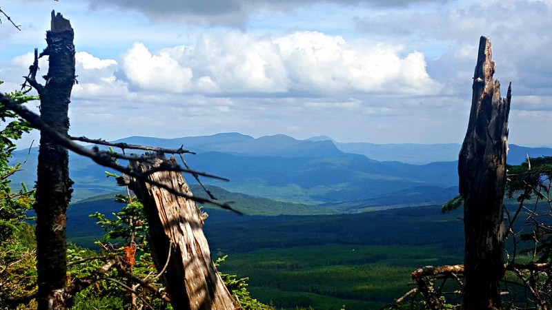
A rare view seen on a bushwhack! Anyone see the bug on the right side of the photo? That’s right, blackflies were out in September!
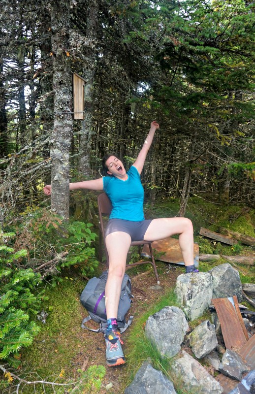
The summit canister is actually a bat house! There’s also a metal chair for when you want to take a nap. Hey, it was steep!
 We spent some time investigating the other remnants on the summit. There’s an old fire tower. The structure is still up, but the top is in shambles by the summit.
I climbed 3/4 of the way up and was able to see some great views of Western Maine as well as Canada. I didn’t take any photos of this view as the state of the structure in the wind meant two hands at all times!
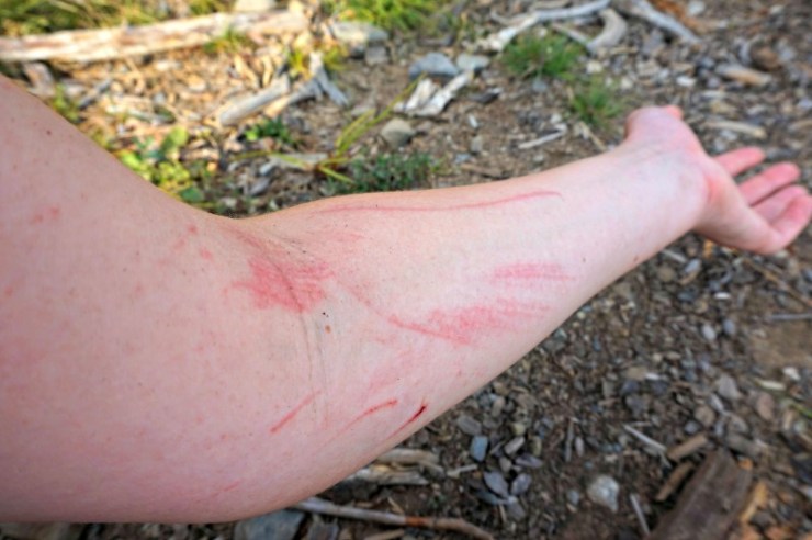
On the way down from the summit I slipped on a hidden root. As I fell, my arm conveniently flailed into the opening of a split tree. I only sustained small bruises and cuts on my legs from three days of bushwhacking, but my arm got the worst of it! It’s not a hike if you don’t take a spill!
Hike 2: East Kennebago Divide (3784’)
Trail Data: East Kennebago Divide: 3.26 miles RT, 1254’ elevation gain
Hiking: logging road, boundary swath, herd paths
Directions to trailhead:
Take route 16 north from Rangeley. Go approximately 9.5 miles from the Route 16/4 junction and take a left onto a dirt road (caution: road has deep dips from culverts). Low clearance cars may not be able to access this road. Cross a wooden bridge, turn right. Bear right at .9 mile. Bear left after another ~1 mile. Turn left again after another ~3 miles. Parking is on the right at a sharp left turn (about 4.2 miles from Route 16).
Note: We met another hiker who was unable to access this trailhead as he had a low clearance car. This was the worst road we encountered of the six peaks we went to.
Hike:
This hike was a continuation in today’s theme: steep but easy to navigate hikes. Don’t be fooled by the measly 1254’ elevation gain. The trail is only 1.63 miles up so much of it is steep, but it’s so short. I really liked pairing this one with Chain of Ponds Snow for an easier day.
The parking area has really great views (the only views of the day). To begin the hike continue up the road uphill past the sign that says “STOP, view ends here, and no dumping”.
You will hike parallel to the view on your right.
The road gets grassy and there are a few blowdowns, but it is easy to follow. The road narrows and the grass becomes taller.
On the left you will see a small cairn and a yellow painted marker. Take this turn. This is the start of a boundary cut of two townships.
It’s blazed yellow with some random blue blotches. This swath becomes steep and could be difficult if wet as there are a couple rocky portions.
This boundary cut continues until you reach a yellow/blue blazed tree, an arrow, and a small cairn. The arrow looks more like an arrow the longer you stare at it! You turn right here, leaving the boundary swath. On this herd path, you make the final steep ascent to East Kennebago Divide.
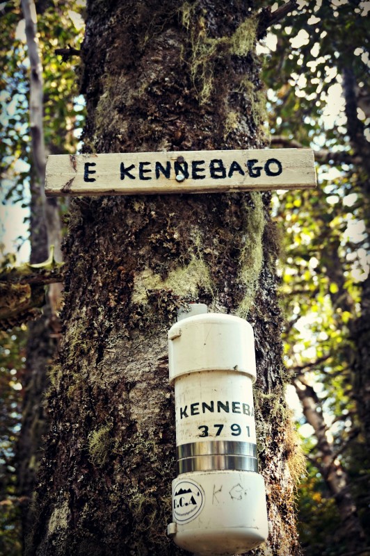
As long as you know the markers to look for, navigation for this hike is very easy. The summit is marked by a sign, canister, and part of a moose skull!
Last modified: September 1, 2017

It’s just East Kennebago, no “Divide”. You may confuse people looking for North Kennebago Divide. Also, bushwhacks don’t have trailheads… These are trailed peaks.