This trip was part of a 3 day adventure in Northwestern Maine, bagging six trail-less New England Hundred Highest peaks. Read about my hike to White Cap and North Kennebago or Chain of Ponds and East Kennebago.
Because two members of our group didn’t have passports we made an alternative plan. Instead of hiking Boundary Peak from the US side (which is a full day) we used the last day we had off to bag Cupsuptic Snow and Elephant on our drive home! Okay, it wasn’t really on our route, but it was heading south!
Day 3- 9/8/2015: Cupsuptic Snow (3784’) and Elephant Mountain (3772’)
Hike 1: Cupsuptic Snow
Trail Data: Cupsuptic Snow: 3.9 miles, 1200’ elevation gain
Hiking: Logging road, bushwhack, herd path
Directions to trailhead:
We had attempted heading down Wiggle Pond road a previous day and found it very narrow and steep in the center. We found a really nice route to get there to avoid much of this mess:
From Route 16 Take Morton Cutoff. (3.1 miles)
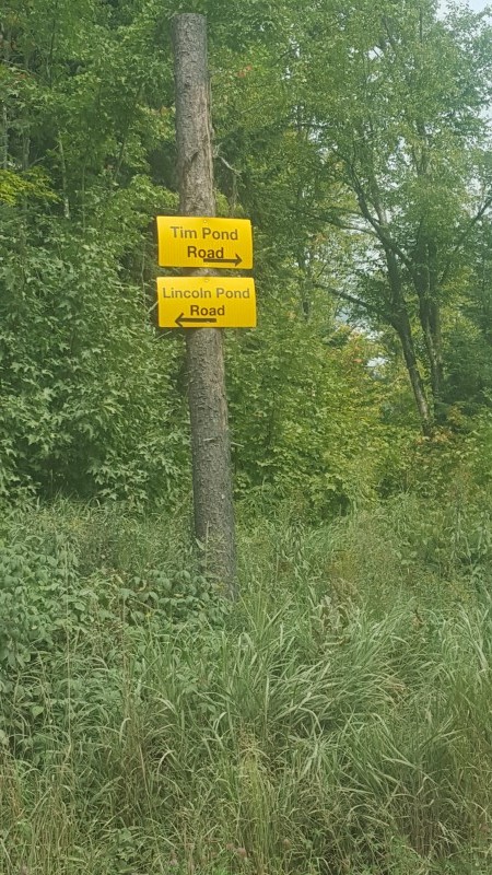
Take a right on Tim pond Rd. You’ll also see a sign for Lincoln pond Rd. Cross a bridge. There are some bumpy stretches on this road. (7.5 miles)
Take a left on Kennebago River Rd. (3.2 miles)
Take a left onto Wiggle Brook Rd. You will cross over a bridge toward the end of this road. (4.2 miles)
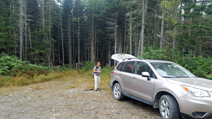
Sign on tree on left says cupsuptic snow. Not visible from turn, but the road is obvious. In .4 the parking is on your right.
Hike:
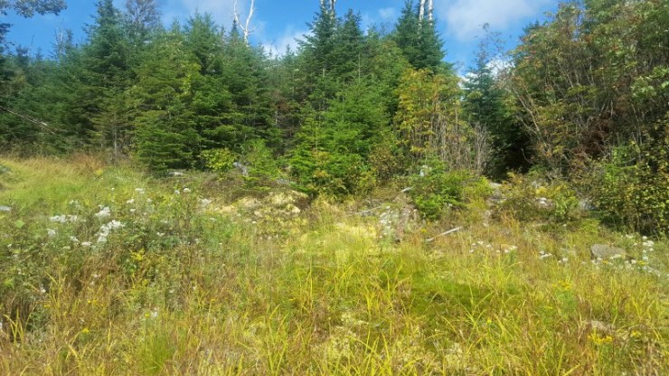
From the parking area, begin hiking straight on the logging road. It quickly becomes tall and grassy. At a little over a quarter mile take a left at a small cairn. It’s another grassy road. This section was very swampy and muddy but it was a nice relief for us after two very hot days of hiking.
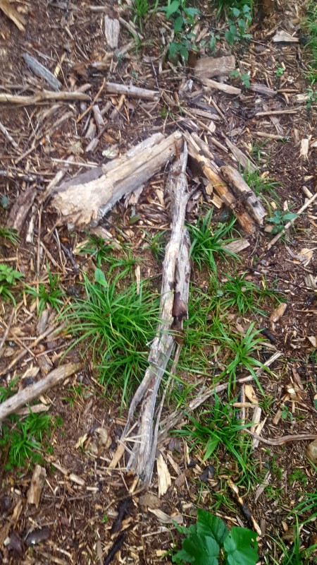
You will come to a large field. You will see a large wood arrow on the ground and a cairn. Pointing straight. Follow suit and continue straight. (wood arrow/cairn photo)
This section is littered with culverts, but is still a logging road. You will follow this until you reach a rectangular dirt area with some newer growth.
Head to the far right right end of the lot you will see two paths. Follow the path on the left marked by a cairn.
After about 50 feet you will see an arrow on the ground pointing left. We walked right by this so pay close attention.
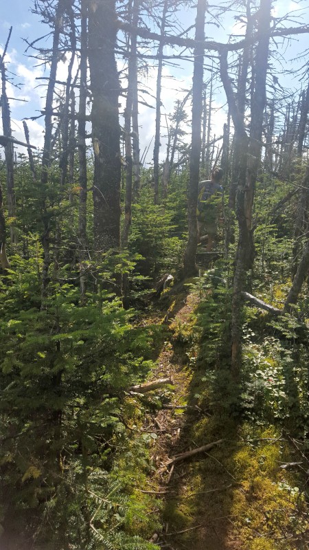
You then follow a path that is often hidden by ferns. It becomes difficult to stay on this path as it is hard to see.
Follow the ridge and look for small cairns as you ascend. You will enter the woods
and then back onto the herd path where it is easier to follow.
There are a couple of blowdowns but the herd path is generally easy to follow once you are past the ferns.
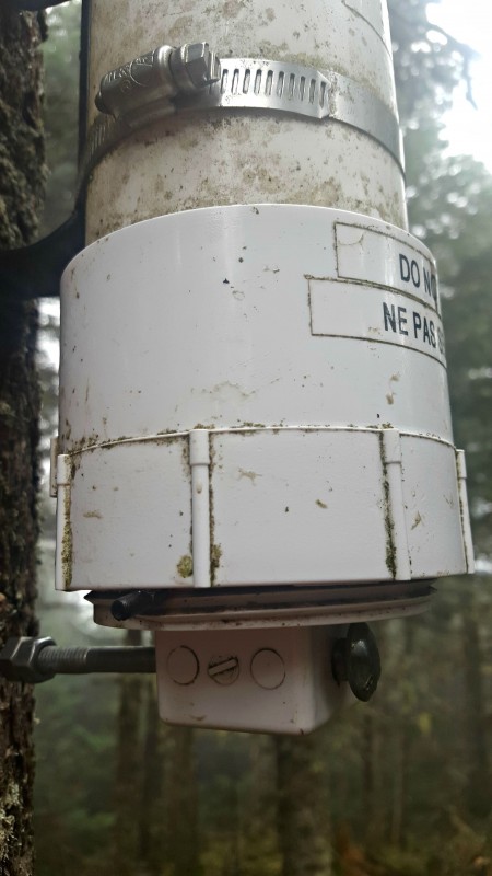
The summit is marked by a sign and canister.
Unfortunately there’s a screw jammed in the thread so we couldn’t open up the canister! These canisters hold a ziplock bag containing a notepad and pen to write a note for the next people to see.
When we were just about at the trailhead Amy saw super fresh bear prints! We must have just missed an opportunity to see one. All our gabbing must have scared the bear off!
Hike 2: Elephant Mountain
Trail Data: Elephant Mountain: ~3 miles, 1140’ elevation gain
Hiking: Logging road, bushwhack
Directions to trailhead:
The parking for Elephant is located on Elephant Mountain Road in Andover Maine. I was able to locate this road on MapQuest but not Google Maps.
We decided to bag this peak on our way home. It’s not quite on our route back to Concord, NH but it was close enough!
From Bethel take Route 5 toward Andover. Turn right onto ME 120 and in .6 miles turn left onto South Arm Road. The right turn onto Elephant Mountain Road is about 10 miles down South Arm Road, past an Appalachian Trail junction and immediately after crossing the signed Clearwater Brook. There is another brook right after the road as well.
Hike:
From the parking area, continue to hike up the logging road. Soon after you start you will see a cairn. Stay left. (cairn photo)
You will then come to a fork with a cairn on the left and multiple colored flagging on the right. Go left here.
One issue with this peak is there is another nearby peak to the Northeast that you can get to using some of these heard paths so pay special attention to your route.
The herd path was generally easy to follow.
There were a couple instances where other herd paths (likely from animals) made us think twice. Other people had reported many blowdowns, but many had described Elephant Mountain as a “free for all” meaning there is no established herd path or general bushwhack route once you make those first few turns. By staying left, we did stay on the herd path a good amount.
Eventually we made it to a marshy area that others had talked about.
From there we experienced the “free for all” ascent. We had a gps track but ended up ascending in the center of Dolores’ two routes. We made an effort to continue to make our way towards one of the routes. The woods were very thick.
On the plus side, we got an amazing view I hadn’t heard others mention before!
Eventually a herd path near the summit emerges and we find the canister, elephant nose and all!
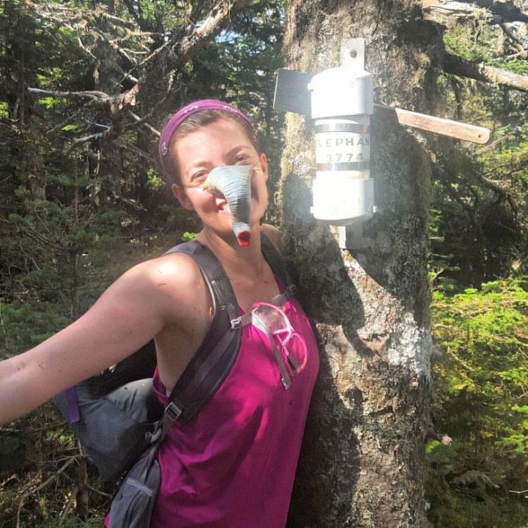
I enjoyed reading these entries, especially one from someone fresh off the AT!
bushwhacking recommendations:
- Make sure to have the most up to date Delorme Atlas and Gazetteer (currently the 2013 version) to navigate to each trailhead.
- It is recommended to bring a high clearance vehicle. We met one hiker working on the NE111 list who was not able to drive down to East Kennebago with his (Toyota?). I drove in a Subaru Forester which handled the logging roads beautifully. Make sure your car has no issues before doing these drives.
- Take into account driving time when planning your hikes. A 2 mile stretch could take 20 minutes or more when avoiding rocks and deep culverts.
During the weekday logging operations are likely. Logging trucks always have the right of way on logging roads and DO NOT slow down. Always be aware of the road ahead as these roads can be extremely narrow. - Wear protective goggles and if you can stand it, long pants and sleeves. Check out my bushwhacking gear list for everything I bring and the reasons why.
Last modified: September 1, 2017

